News · Environment & Climate
El Niño to intensify before December peak - UN
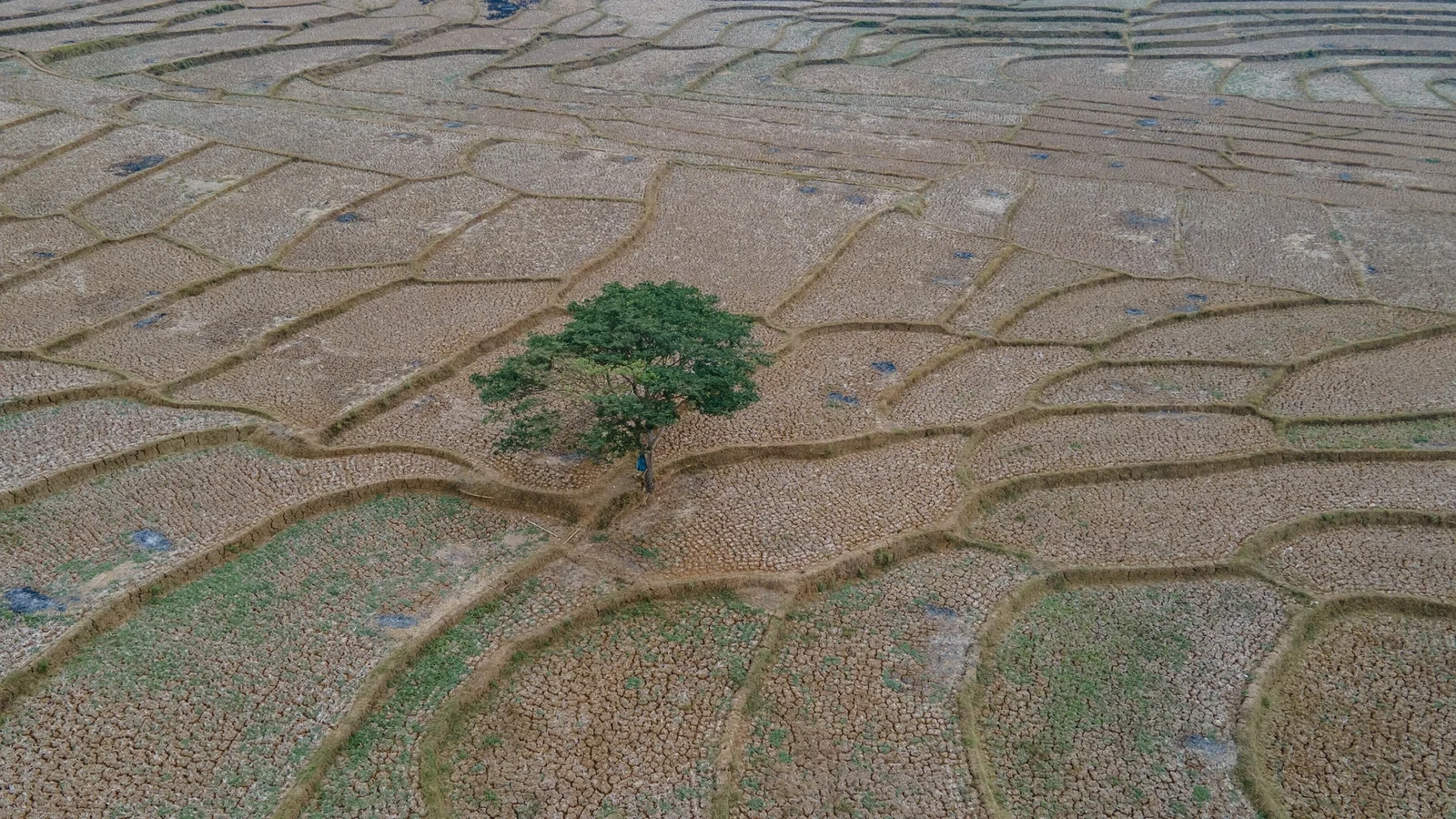
El Niño is not yet at its expected maximum. The World Meteorological Organization says the event will continue intensifying before its forecast peak in December. That matters because stronger El Niño conditions can reshape weather across much of the world. Sea-surface temperatures in the central and eastern tropical Pacific are forecast to rise during October-November-December 2026. The temperature anomaly could reach about 3.7C above normal. The WMO says this warming will influence winds, rainfall, and temperatures worldwide. The forecast gives El Niño a near-100% chance of lasting through February 2027. It could become one of the strongest events observed since at least 1950. Its effects may include higher temperatures, shifting rainfall, drought in some places, and floods in others.
Based on reporting by RTE Ireland
What is expected to happen to El Niño before its forecast peak in December?
El Niño is not yet at its expected maximum. The World Meteorological Organization says the event will continue intensifying before its forecast peak in December. That matters because stronger El Niño conditions can reshape weather across much of the world.
Sea-surface temperatures in the central and eastern tropical Pacific are forecast to rise during October-November-December 2026. The temperature anomaly could reach about 3.7C above normal. The WMO says this warming will influence winds, rainfall, and temperatures worldwide.
The forecast gives El Niño a near-100% chance of lasting through February 2027. It could become one of the strongest events observed since at least 1950. Its effects may include higher temperatures, shifting rainfall, drought in some places, and floods in others.
What is El Niño, and where in the Pacific Ocean does it begin?
El Niño is a naturally occurring weather phenomenon involving unusually warm surface waters in the Pacific Ocean. It begins in the central and eastern equatorial Pacific, the region at the heart of the event. Its importance comes from how this ocean warming affects atmospheric conditions around the globe.
When Pacific surface temperatures rise, they alter worldwide winds, air pressure, and rainfall patterns. These changes can move rain away from some regions and toward others. They can also contribute to higher temperatures across much of the planet.
El Niño usually occurs every two to seven years and lasts around nine to 12 months. The current event is firmly established and strengthening rapidly. The WMO expects it to influence weather patterns, economies, ecosystems, and communities across the globe.
How strong could this El Niño become compared with past events?
The current El Niño could be exceptionally strong. The WMO says it may become one of the strongest events witnessed since at least 1950. Its projected intensity matters because stronger ocean warming can produce broader and more disruptive effects on weather and communities.
The central-eastern equatorial Pacific temperature anomaly rose from 1.6C above normal in June to 2.5C above normal in August. For October-November-December, it is forecast to reach approximately 3.7C above normal. That would exceed the previous observed record of 2.6C, set in 2015-2016.
The forecast is based on agreement among 13 leading meteorological centres. The WMO also gives the event a near-100% likelihood of persisting through February 2027. Its final strength will determine how severely different regions experience heat, drought, or flooding.
How do unusually warm Pacific Ocean temperatures change winds, rainfall, and temperatures around the world?
El Niño warms surface waters in the central and eastern equatorial Pacific. That extra warmth changes the atmosphere above the ocean. The altered conditions then shift winds, air pressure, and the movement of rainfall around the world.
The key mechanism is a change in rainfall patterns. Some regions receive less rain and face drought, while others receive unusually heavy rain and face flooding. The event also contributes to above-average temperatures across much of the globe. Its effects do not remain near the Pacific.
The current forecast illustrates the scale of the change. Pacific temperatures could reach about 3.7C above normal during October-November-December 2026. The WMO expects the event to affect weather patterns, economies, ecosystems, and communities. Temperature spikes may arrive later, often after El Niño itself peaks.
Why can El Niño cause droughts in some regions, floods in others, and higher temperatures worldwide?
El Niño begins with unusually warm surface water in the central and eastern equatorial Pacific. This warming changes winds and air pressure, which shifts where rain falls. Because rainfall patterns are connected across the atmosphere, different regions can experience sharply different conditions.
Places receiving less rain may develop drought, while areas receiving more intense rainfall may face floods. At the same time, El Niño contributes to above-average temperatures over much of the planet. The WMO warns that these effects can strain communities, ecosystems, and economies.
El Niño does not add new heat to the planet, according to Celeste Saulo. Instead, it releases heat already stored in the ocean. The ocean is currently the warmest ever measured, leaving more heat available to release. This helps explain why the event can amplify global heat while changing rainfall patterns.
How does this El Niño interact with human-caused climate change and the unusually warm global ocean?
Human-caused climate change and El Niño can reinforce unusually high temperatures. El Niño is a natural event, but the WMO says its impact compounds the effects of man-made climate change. This matters because weather extremes occur against an already warmer climate background.
Celeste Saulo explained that El Niño does not add new heat to the planet. It releases heat stored in the ocean. The ocean it is drawing from is the warmest ever measured, so there is simply more heat available to release into the atmosphere.
The previous El Niño helped make 2023 the second-hottest year on record, while 2024 became the hottest, at about 1.55C above the pre-industrial average. The current event is forecast to intensify and persist through February 2027. Its temperature effects may therefore remain significant after its December peak.
What are La Niña and neutral conditions, and how do they fit into the repeating El Niño–La Niña cycle?
El Niño and La Niña are opposite phases of a recurring Pacific climate pattern. El Niño features warming in the central and eastern equatorial Pacific. La Niña is its opposite, while neutral conditions occur between the two phases.
The phases matter because they are linked to different atmospheric behavior. El Niño changes winds, pressure, and rainfall patterns worldwide, and the article identifies La Niña as its opposite. Neutral conditions represent the interval between these two states rather than either extreme.
The cycle does not follow a strict annual schedule. El Niño typically occurs every two to seven years and lasts around nine to 12 months. The current event is firmly established and strengthening rapidly, with a near-100% likelihood of continuing through February 2027. The article does not specify when La Niña or neutral conditions will next occur.
Key Facts:
📌 El Niño is forecast to strengthen before peaking in December.
📌 Pacific temperatures could reach 3.7C above normal.
📌 The event may persist through February 2027.
📌 El Niño warms the central and eastern equatorial Pacific.
📌 It changes worldwide winds, pressure, and rainfall patterns.
📌 El Niño typically lasts around nine to 12 months.
📌 The Pacific anomaly could reach approximately 3.7C above normal.