News · Environment & Climate
Colombia declares official start of El Niño, warns of strong impacts
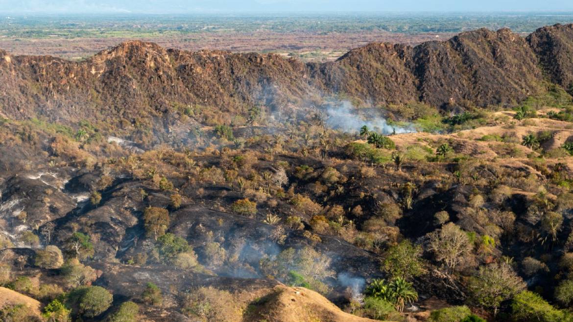
El Niño is a recurring climate pattern in which surface water in the tropical Pacific becomes unusually warm. That extra heat changes the atmosphere above the ocean. The atmosphere then shifts where clouds form, where rain falls, and where dry air develops. Effects can reach regions far from the Pacific, although they vary by location. Warm Pacific water adds heat and moisture to the air. Rising air produces clouds and heavy rain in some areas, while atmospheric circulation can move rainfall away from others. During this event, Colombia’s meteorological institute, IDEAM, said sustained Pacific warmth was disrupting local climate patterns and could reduce rainfall during a normally wet season. IDEAM declared El Niño in Colombia and warned of water shortages and forest fires. It said the phenomenon could continue affecting local weather until March next year. The response includes wildfire monitoring, protection for water sources, and plans to secure energy supplies if dry conditions weaken hydropower generation.
Based on reporting by Colombia Reports
What is El Niño, and how does unusually warm water in the Pacific Ocean affect weather around the world?
El Niño is a recurring climate pattern in which surface water in the tropical Pacific becomes unusually warm. That extra heat changes the atmosphere above the ocean. The atmosphere then shifts where clouds form, where rain falls, and where dry air develops. Effects can reach regions far from the Pacific, although they vary by location.
Warm Pacific water adds heat and moisture to the air. Rising air produces clouds and heavy rain in some areas, while atmospheric circulation can move rainfall away from others. During this event, Colombia’s meteorological institute, IDEAM, said sustained Pacific warmth was disrupting local climate patterns and could reduce rainfall during a normally wet season.
IDEAM declared El Niño in Colombia and warned of water shortages and forest fires. It said the phenomenon could continue affecting local weather until March next year. The response includes wildfire monitoring, protection for water sources, and plans to secure energy supplies if dry conditions weaken hydropower generation.
How unusually warm was the Pacific Ocean in this event, and what does a sea-surface temperature anomaly of +3.49°C mean?
IDEAM reported a sea-surface temperature anomaly of +3.49°C in the Pacific Ocean. An anomaly measures how far a current temperature differs from a long-term reference average. Therefore, +3.49°C means the measured surface water was 3.49°C warmer than that comparison level. It is not the ocean’s total temperature.
The figure matters because ocean surface temperatures strongly influence the atmosphere above them. Much warmer water releases additional heat and moisture into the air. That can alter cloud formation, winds, and the movement of rain. IDEAM said the latest measurement broke records, indicating an unusually intense ocean signal for this El Niño event.
The warmth has practical consequences for Colombia. IDEAM expects reduced rainfall between October and December, when much of the country normally receives rain. If the disruption continues until March, officials fear greater pressure on water supplies, forests, and hydroelectric power generation.
Why is El Niño expected to reduce rainfall in Colombia during October to December, even though those months are normally rainy?
October to December is normally a rainy season across large parts of Colombia. El Niño changes that expectation by warming the Pacific and shifting atmospheric circulation. Those changes can move rising air, clouds, and moisture away from Colombia or weaken the systems that usually deliver rain. As a result, a season that is normally wet can become unusually dry.
The article connects the expected rainfall reduction directly to the current El Niño conditions. IDEAM reported sustained warm Pacific waters and said the phenomenon could disrupt Colombia’s local climate patterns. It expects the initial rainfall decline between October and December, rather than during an ordinarily dry period.
This timing makes the threat especially serious. Water managers may receive less rain precisely when they expect replenishment. Lower rainfall can reduce water available for communities and ecosystems, increase forest-fire danger, and leave hydroelectric reservoirs under pressure. Officials therefore ordered contingency plans to be ready by November 30.
What could happen to Colombia’s water supplies, forests, agriculture, and electricity generation if the dry conditions continue until March?
If dry conditions last until March, Colombia could face several linked problems. Less rain means reduced water supplies for people, ecosystems, and economic activities. Dry vegetation also burns more easily, raising the risk of forest fires. Agriculture could suffer from insufficient water for crops, although the article does not provide crop-specific impacts.
Electricity is another major concern because hydroelectric plants depend on water flowing through reservoirs and rivers. EPM, Medellin’s local utilities firm, has been testing water rations because it fears low rainfall could affect the hydroelectric plants supplying much of northwest Colombia’s energy. A long dry period could therefore connect a weather emergency with an energy challenge.
IDEAM expects local climate disruption to continue until March next year. In response, Colombia is monitoring fires, protecting water sources and vulnerable ecosystems, and strengthening thermal generation. The government also ordered contingency plans, conservation measures, and other preparations before conditions worsen.
Which Colombian agencies are responding to the threat, and what specific actions are they taking to manage fires, water sources, and energy supplies?
The National Unit for Disaster Risk Management, or UNGRD, coordinates response capabilities across Colombia. It is enhancing wildfire monitoring with satellite technology. The Ministry of Environment and Sustainable Development is protecting strategic ecosystems, water sources, and the areas considered most vulnerable to the climate threat.
The Mining Ministry is carrying out an emergency energy plan. Its measures include strengthening thermal power generation, securing fuel supplies, and introducing efficiency and conservation measures. EPM, the utilities firm in Medellin, is testing water rations because it fears reduced rainfall could affect hydroelectric plants that supply much of northwest Colombia’s energy.
The national government launched an interagency response after earlier alerts. The President’s Office said responsible agencies had to formulate and activate contingency plans by November 30 at the latest. IDEAM continues to assess the climate event, while officials prepare for possible effects through March next year.
Why can a lack of rain threaten Colombia’s electricity supply, and how could thermal power, solar panels, and energy conservation reduce that risk?
Hydroelectric plants generate electricity from moving or stored water. When El Niño reduces rainfall, reservoirs and rivers may receive less water, weakening this source of power. EPM is testing water rations because it fears low rain could affect hydroelectric plants that provide much of northwest Colombia’s energy. Dry conditions can therefore threaten both water access and electricity supply.
Thermal power offers another route because the Mining Ministry can increase generation using fuel rather than relying directly on rainfall. Securing fuel supplies helps keep those plants operating. Solar panels provide electricity from sunlight, adding a separate source to the grid. Before leaving office on August 7, former President Gustavo Petro ordered a mass purchase of solar panels.
Energy efficiency and conservation reduce demand during the emergency. Using less electricity means the system needs less generation from stressed hydroelectric plants. Together, thermal power, solar energy, and conservation can spread the burden across more sources. The government’s plan aims to protect energy security while El Niño continues disrupting rainfall.
How do ocean temperatures, trade winds, evaporation, and atmospheric circulation interact to create El Niño and change rainfall far from the Pacific?
Normally, trade winds help move warm surface water across the tropical Pacific. During El Niño, those winds weaken or change, allowing warm water to spread differently across the ocean. The warmer surface increases evaporation, adding heat and moisture to the atmosphere. This changes where air rises, clouds build, and rain develops.
Rising air over unusually warm water can produce heavy clouds and rain in one part of the Pacific. Air then circulates through the atmosphere and sinks elsewhere, creating drier conditions there. These large-scale circulation changes can influence winds, cloud tracks, and rainfall far from the ocean’s warmest waters. The exact effects depend on location.
The article reports that Pacific warmth reached a +3.49°C sea-surface temperature anomaly and broke records. IDEAM expects Colombia’s rainfall to decrease from October through December and local climate disruption to last until March next year. That is why officials are preparing for water, fire, and energy risks.
Key Facts:
📌 El Niño involves unusually warm Pacific Ocean conditions.
📌 IDEAM warned of water shortages and forest fires.
📌 The phenomenon could disrupt Colombia’s climate until March next year.
📌 IDEAM measured a Pacific sea-surface temperature anomaly of +3.49°C.
📌 The latest measurement broke records, according to IDEAM.
📌 An anomaly compares current temperature with a reference average.
📌 IDEAM expects rainfall to decline between October and December.