News · Environment & Climate
WMO forecasts a very strong El Niño peaking at year's end and lasting into February 2027
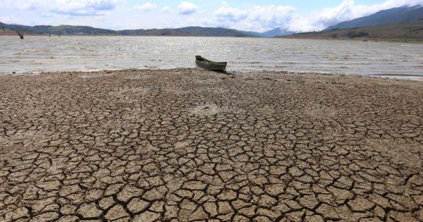
El Niño is a climate pattern in which unusually warm surface waters develop across the central and eastern tropical Pacific. That extra heat changes the atmosphere above the ocean. Because the tropical Pacific is enormous, the resulting shifts in winds, clouds, and rainfall can influence weather across distant continents. “Firmly established” means observations show the pattern is already occurring and has become organized enough for scientists to identify confidently. It is more than an early hint in ocean temperatures. The atmosphere is also responding, helping reinforce the event through changes in tropical winds and rainfall. The article says El Niño is now firmly established in the tropical Pacific. The WMO expects it to intensify over the coming months and become very strong. This matters because a stronger, established event generally gives climate effects more opportunity to spread and persist, although exact impacts differ by region.
Based on reporting by MercoPress South America
What is El Niño, and what does it mean for it to be firmly established in the tropical Pacific?
El Niño is a climate pattern in which unusually warm surface waters develop across the central and eastern tropical Pacific. That extra heat changes the atmosphere above the ocean. Because the tropical Pacific is enormous, the resulting shifts in winds, clouds, and rainfall can influence weather across distant continents.
“Firmly established” means observations show the pattern is already occurring and has become organized enough for scientists to identify confidently. It is more than an early hint in ocean temperatures. The atmosphere is also responding, helping reinforce the event through changes in tropical winds and rainfall.
The article says El Niño is now firmly established in the tropical Pacific. The WMO expects it to intensify over the coming months and become very strong. This matters because a stronger, established event generally gives climate effects more opportunity to spread and persist, although exact impacts differ by region.
How strong is a “very strong” El Niño compared with a typical El Niño event?
A very strong El Niño is substantially more intense than an ordinary El Niño, but there is no single universal amount by which it is stronger. Scientists usually compare sea-surface temperatures in a standard central Pacific region with the long-term average. They also examine atmospheric changes, such as weakened trade winds and altered tropical rainfall.
In practice, a very strong event means the temperature anomaly is unusually large and the ocean–atmosphere system is strongly coupled. It does not mean every location experiences effects that are proportionally larger. Regional outcomes also depend on season, geography, and other climate patterns.
The article describes the coming event as “very strong,” but it does not provide a temperature value or rank it against a typical El Niño. Therefore, the safest comparison is qualitative: it is expected to be unusually intense, with potentially broader or stronger climate effects than a moderate event.
When is this El Niño expected to peak, and how long are its effects expected to last?
According to the WMO update, this El Niño should intensify during the coming months and reach its peak toward the end of 2026. A peak is the period when the relevant Pacific ocean temperatures and related atmospheric signals are expected to be strongest. It does not necessarily mark the end of the event’s influence.
El Niño affects global circulation through linked changes in ocean heat, winds, clouds, and rainfall. Those systems do not switch back instantly when Pacific temperatures begin falling. Seasonal timing also matters, because a lingering circulation pattern can influence different regions differently as the calendar changes.
The article expects climate effects to extend well into 2027. It does not specify a precise ending month or predict identical conditions throughout that period. The main message is that a late-2026 maximum could be followed by a prolonged period of altered weather and climate patterns.
What weather and climate changes can a very strong El Niño cause around the world?
A very strong El Niño can alter normal patterns of rain, heat, drought, and storms. It can bring intense rainfall and flooding to some places while reducing rain and increasing drought risk elsewhere. Global average temperatures may also rise because warm Pacific waters release extra heat into the atmosphere.
The mechanism is a large-scale change in tropical Pacific convection. Warm water encourages clouds and thunderstorms in different locations than usual. This changes rising and sinking air, which alters jet streams and storm tracks. Those circulation changes can influence weather thousands of kilometers away, including the position and strength of seasonal rainfall systems.
The article confirms a very strong event but does not provide a country-by-country forecast. Specific effects will depend on the season and local geography. Since the WMO expects effects well into 2027, governments and communities may need to prepare for extended risks involving water, heat, agriculture, health, and disasters.
Which regions are most likely to experience unusually wet, dry, hot, or stormy conditions during this event?
During many El Niño events, western South America can experience unusually heavy rain, while Australia, Indonesia, and parts of Southeast Asia often face drier conditions. Some areas of the southern United States commonly become wetter, while parts of southern Asia may experience disrupted rainfall. These are broad tendencies, not guarantees.
The same event can also shift storm tracks. Winter weather may become stormier in some subtropical regions and quieter in others. Heat can spread widely because the warm Pacific releases energy into the atmosphere. Local outcomes depend on season, coastlines, mountains, and other climate patterns operating at the same time.
The article does not name particular regions or give a detailed impact map. It only says the event will be very strong and affect climate into 2027. Therefore, these regional patterns describe established El Niño tendencies, not a precise forecast for every location in this event.
How does a change in ocean temperatures in the tropical Pacific affect weather patterns thousands of kilometers away?
The tropical Pacific acts like a powerful heat engine. When its surface waters become unusually warm, more water evaporates and more heat enters the atmosphere. This encourages thunderstorms and rising air over different parts of the ocean than during neutral conditions. The change can then spread through the global circulation.
Air that rises in the tropics must eventually sink elsewhere. That redistribution changes pressure, winds, and the position of jet streams. Jet streams guide storms, while pressure patterns influence where moist air travels. As a result, a Pacific temperature change can alter rainfall and temperature thousands of kilometers away, even where the local ocean is unchanged.
The article reports that El Niño is firmly established and expected to become very strong. It does not explain the physical mechanism, but this established climate science explains why the WMO expects effects extending into 2027. The distant impacts are connected responses, not separate local events.
How do scientists measure and forecast El Niño, and how does it fit into the recurring El Niño–Southern Oscillation cycle?
Scientists monitor sea-surface temperatures in key tropical Pacific regions, especially the central and eastern Pacific. They also measure trade winds, air pressure, rainfall, clouds, and subsurface ocean heat. Satellites, buoys, ships, weather stations, and ocean instruments provide these observations. Together, they show whether the ocean and atmosphere are acting as a coupled system.
Forecast centers feed those observations into climate models. Models simulate ocean currents, atmospheric circulation, and heat exchange, then produce probabilities for future conditions. Forecasts become less certain farther ahead, so scientists update them as new observations arrive. No single measurement determines the entire event.
El Niño is the warm phase of ENSO. La Niña is the cooler phase, and neutral conditions lie between them. The article says this El Niño is established and should peak late in 2026, but it gives no measurement details or model probabilities. Those specific scientific methods come from established climate practice.
Key Facts:
📌 - El Niño is warming in the tropical Pacific Ocean.
📌 - Established means the ocean–atmosphere pattern is already clearly underway.
📌 - The WMO expects this event to intensify.
📌 - “Very strong” places El Niño near the upper end of intensity.
📌 - Scientists compare Pacific temperatures with long-term averages.
📌 - The article gives no exact strength multiplier.
📌 - El Niño is expected to peak toward the end of 2026.